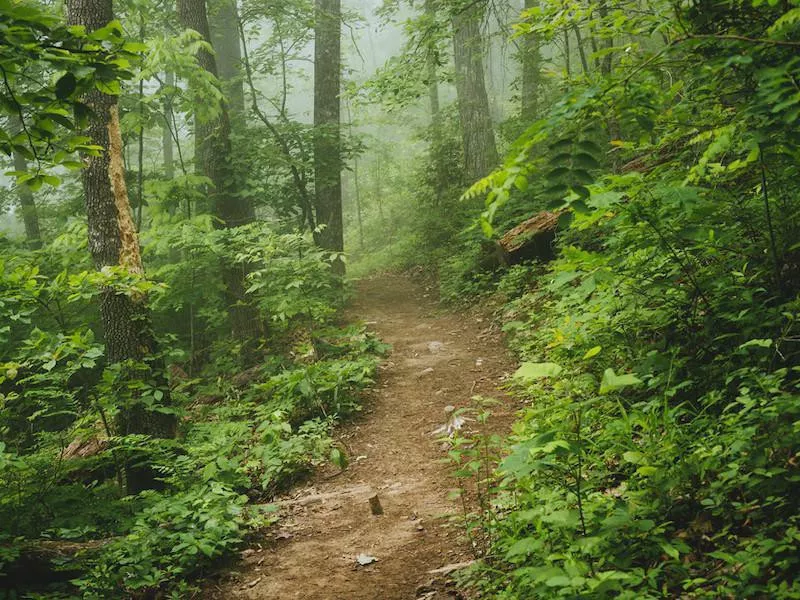
"Of all the paths you take in life, make sure a few of them are dirt," said John Muir, considered the "Father of National Parks."
Whether you have always enjoyed taking the path less traveled or life has led you to seek space and time away from others in the great outdoors, these are the best local hiking trails in every state.
Far & Wide turned to AllTrails for this definitive list. With a community of 20 million hikers weighing in to rank more than 100,000 trails, you can trust that these hikes across the United States will be worth the effort.
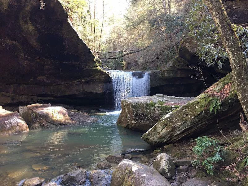
Alabama: Walls of Jericho Trail
Getty
Length: 9 miles
Location: Scottsboro
Duration: 4.37 hours
Difficulty: Hard
You'll find a waterfall on the Walls of Jericho Trail, which may mean more crowds along the way. Don't forget your hiking boots because you can expect to climb 1,699 feet on this out-and-back trail in northern Alabama, where dogs are also welcome.
* All the hyperlinks to AllTrails include trail maps and other hike stats.
Alaska: Flattop Mountain Trail
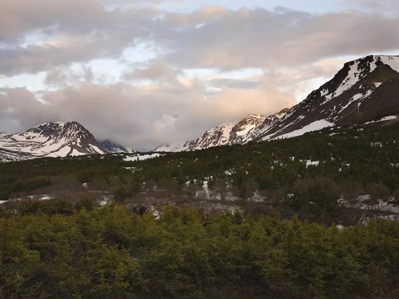
Getty
Length: 3.3 miles
Location: Anchorage
Duration: 2.18 hours
Difficulty: Moderate
Found in Chugach State Park, this short trail gets used by local joggers and walkers from the city out and about with their dogs. Still, the loop rises 1,430 feet and provides some fantastic views.
Arizona: Devils Bridge Trail
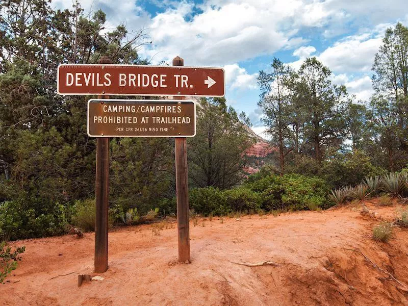
Getty
Length: 4.2 miles
Location: Sedona
Duration: 2.4 hours
Difficulty: Moderate
Another popular trail can be found within the Coconino National Forest outside of Sedona. Known for its red-rock landscape, it will only take you 564 feet in elevation. And, yes, your dog can join you here, too.
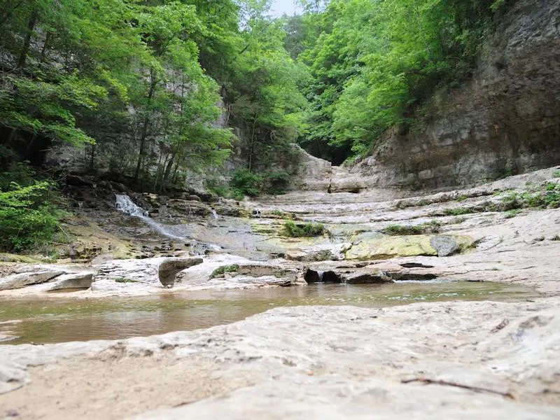
Arkansas: Whitaker Point Trail
Getty
Length: 2.9 miles
Location: Pettigrew
Duration: 1.27 hours
Difficulty: Moderate
This trail in the Ozark National Forest in northern Arkansas will also take you to a waterfall. The climb is 413 feet to catch the view from Hawksbill Crag.
California: Potato Chip Rock via Mt. Woodson Trail
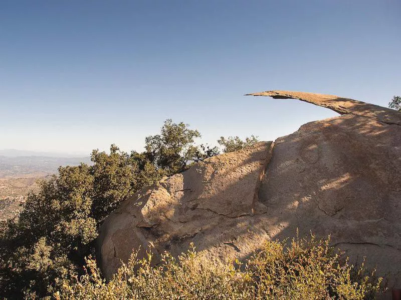
Getty
Length: 7.6 miles
Location: Poway
Duration: 4.29 hours
Difficulty: Hard
California is filled with hiking trails all over the state Yet, the favorite is Mt. Woodson Trail. Found north of San Diego in Lake Poway Park, the trail will take you on a steep hike with scenic views of the Pacific Ocean all the way up to Potato Chip Rock. It's a 2,106-foot climb that can get difficult, but it's considered a must-do for locals and visitors alike who are itching for a quality day hike.
Colorado: Royal Arch Trail
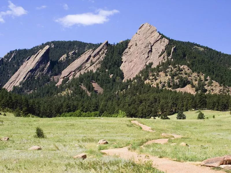
Getty
Length: 4 miles
Location: Boulder
Duration: 2.37 hours
Difficulty: Hard
An extremely popular trail, visit Boulder Open Space and follow the Chautauqua Trail until it branches off at Royal Arch. You'll climb 1,492 feet — even during the winter when you can snowshoe.
Connecticut: Bear Mountain Trail
Length: 9.7 miles
Location: Salisbury
Duration: 3.33 hours
Difficulty: Moderate
Located in Mount Riga State Park, this loop trail has an elevation gain of 1,676 feet. Just south of Massachusett's Berkshire Mountains, this hike draws people from three states to enjoy it.
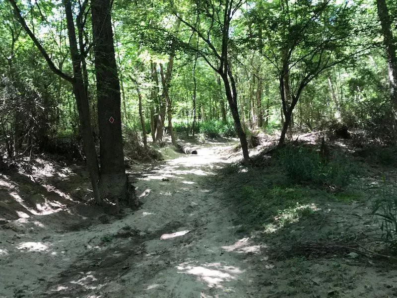
Delaware: Alapocas Woods Trail
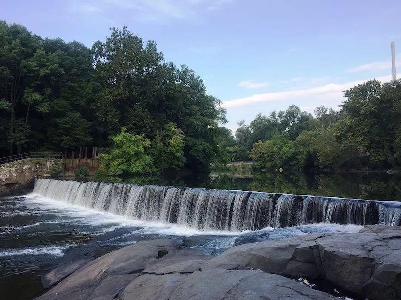
Length: 1.8 miles
Location: Wilmington
Duration: .53 hours
Difficulty: Moderate
It may be a short loop without any climbs, but this trails gives you access to the waterfall (shown). You're just outside of Wilmington on this trail, where dogs are welcome.
Florida: Black Bear Wilderness Area Trail
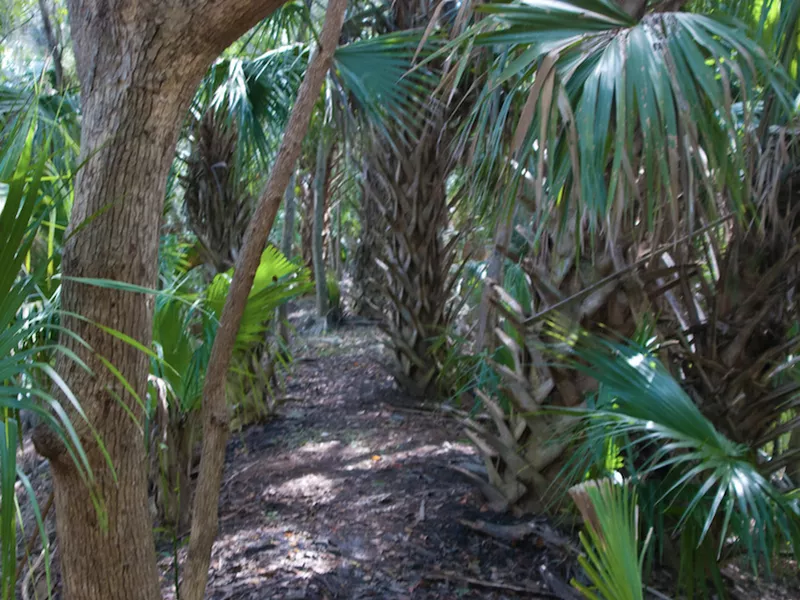
Length: 7.3 miles
Location: Sanford
Duration: 2.57 hours
Difficulty: Moderate
Not all of Florida is made up of sand. This trail found north of Orlando, not too far from Ocala National Forest, loops to take you through palm-filled flatlands with river-facing portions that, yes, may have gators.
Georgia: Mount Yonah Trail
Getty
Length: 4.2 miles
Location: Cleveland
Duration: 2.4 hours
Difficulty: Hard
Chattahoochee-Oconee National Forest in the North Georgia Mountains offers numerous hiking trails, but the 1,450-foot climb up Mount Yonah gets the top spot. Trail hiking here begins in February and goes through November.
Hawaii: Kuliouou Ridge Trail
Getty
Length: 4 miles
Location: Honolulu
Duration: 2.43 hours
Difficulty: Moderate
Within the Kuliouou Forest Reserve outside of Honolulu is a trail that follows along the 1,624-foot Ko'olau Ridge. Although steep, locals use it as a running trail for its quite impressive views.
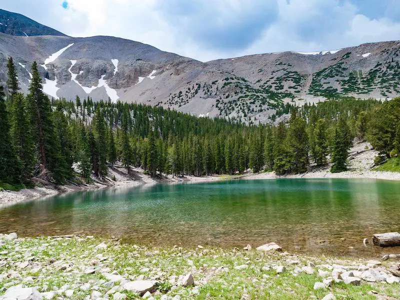
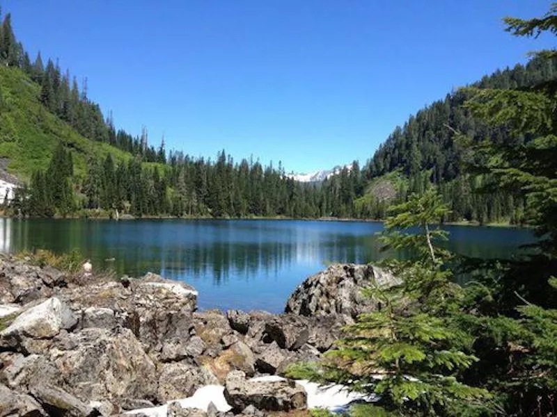
Idaho: Sawtooth Lake
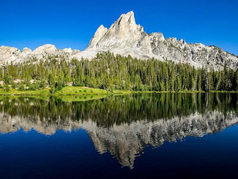
Getty
Length: 10 miles
Location: Stanley
Duration: 5.18 hours
Difficulty: Hard
This river trail to Sawtooth Lake is an out-and-back trail that can be quite difficult. You'll reach heights of 1,873 feet during your 10 miles and catch views of the beautiful lake (shown) from various angles.
Illinois: Little Grand Canyon Trail
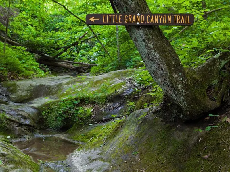
Getty
Length: 3 miles
Location: Ponoma
Duration: 1.31 hours
Difficulty: Moderate
In Shawnee National Forest, you can find what locals have nicknamed the Little Grand Canyon. This loop trail takes you in and around a creek with a waterfall as you explore the canyons of southern Illinois.
Indiana: Cowles Bog Trail
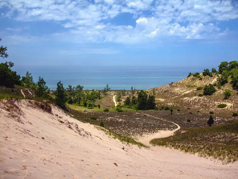
Getty
Length: 4.3 miles
Location: Dune Acres
Duration: 1.52 hours
Difficulty: Moderate
You'll head in and out on the same path to the Cowles Bog loop that will take you to the heart of the dunes in Indiana Dunes National Park, located along Lake Michigan. Visit the beach, and then continue on to see smaller lakes in the area.
Iowa: Maquoketa Caves State Park
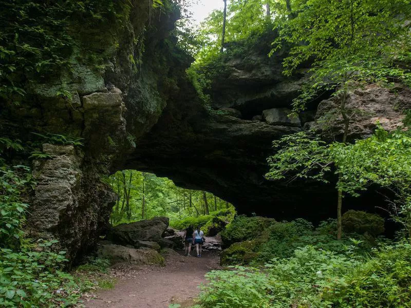
Getty
Length: 1.7 miles
Location: Maquoketa
Duration: .53 hours
Difficulty: Easy
Did you know Iowa has more than cornfields? Maqouketa Caves State Park offers a 1.7-mile loop through forests, along a river and under carved rocks.
Kansas: Elk River Hiking Trail
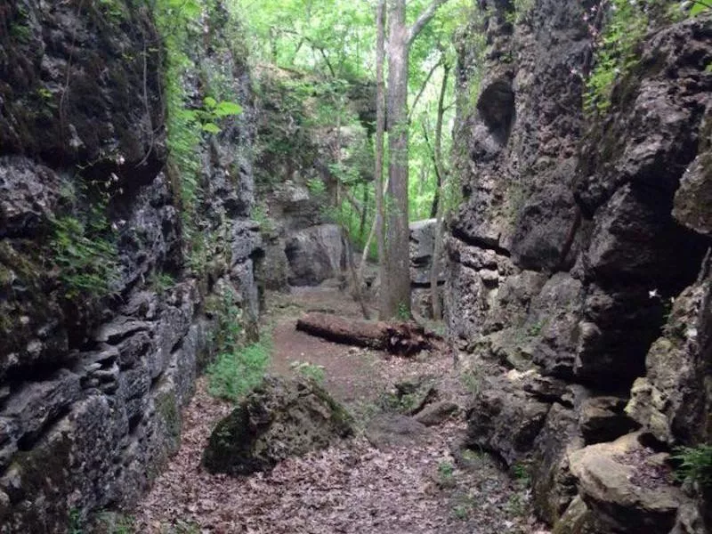
Length: 14.1 miles
Location: Elk City
Duration: 6.16 hours
Difficulty: Moderate
You'll follow this point-to-point trail along a river and streams as you make your way to Elk City Lake. If you don't want to double the distance, you'll need to plan ahead with parking or a ride at the exit point.
Kentucky: Dog Slaughter Falls Trail
Length: 2.6 miles
Location: Corbin
Duration: 1.12 hours
Difficulty: Moderate
Don't worry. The waterfall here isn't as scary as its name implies. Follow this out-and-back trail within Cumberland Falls State Park to catch a peek of the 15-foot falls.
Louisiana: Bogue Chitto State Park Gorge Run Trail
Length: 4.8 miles
Location: Franklinton
Duration: 2.5 hours
Difficulty: Moderate
This moderate trail within Bogue Chitto State Park gets a lot of foot and pet traffic on its sandy loop. Expect plenty of shade and a lakefront beach for a relaxing day.
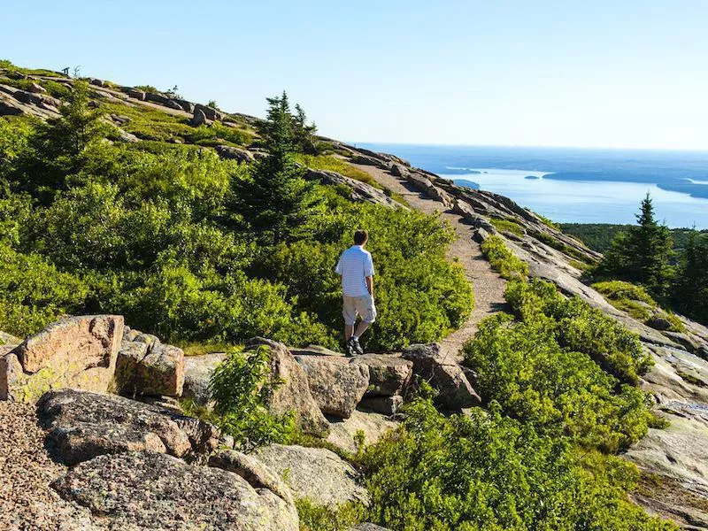
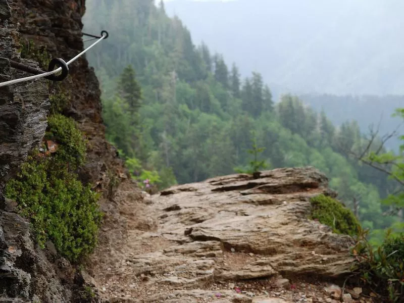
Maine: The Beehive Loop Trail
Getty
Length: 1.4 miles
Location: Seal Harbor
Duration: .54 hours
Difficulty: Hard
Acadia National Park offers a number of trails with views of Maine's rocky coastline, but the favorite is Beehive. This hiking trail is a loop with a steep climb to a scenic overlook. Parts of it are so difficult that strategically placed iron rungs on ledges of exposed cliffs are available to help you reach the top.
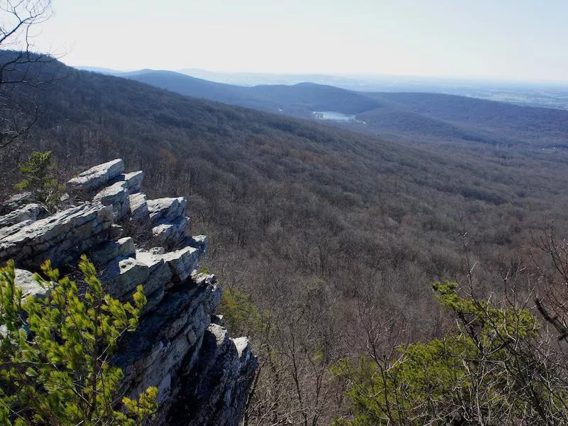
Maryland: Annapolis Rock via Appalachian Trail
Length: 5.1 miles
Location: Boonsboro
Duration: 2.36 hours
Difficulty: Moderate
Hike along the Appalachian Trail to reach Annapolis Rock. You may have to scrabble on this out-and-back hike to get to the views, which are some of the best in the mountains of Maryland. You'll even be able to see Greenbrier Lake in the distance.
Massachusetts: Great Blue Hill via Skyline Trail
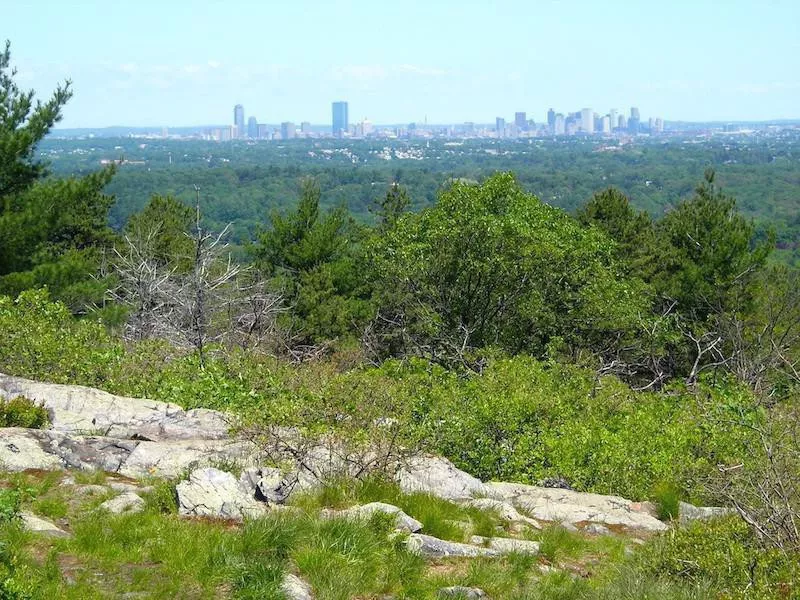
Length: 3 miles
Location: Milton
Duration: 1.13 hours
Difficulty: Moderate
Just outside of Boston are the Blue Hills, where this moderate loop trail will provide you with views of the city in the distance. Locals may use the trail for running, and dogs are welcome.
Michigan: Chapel Loop
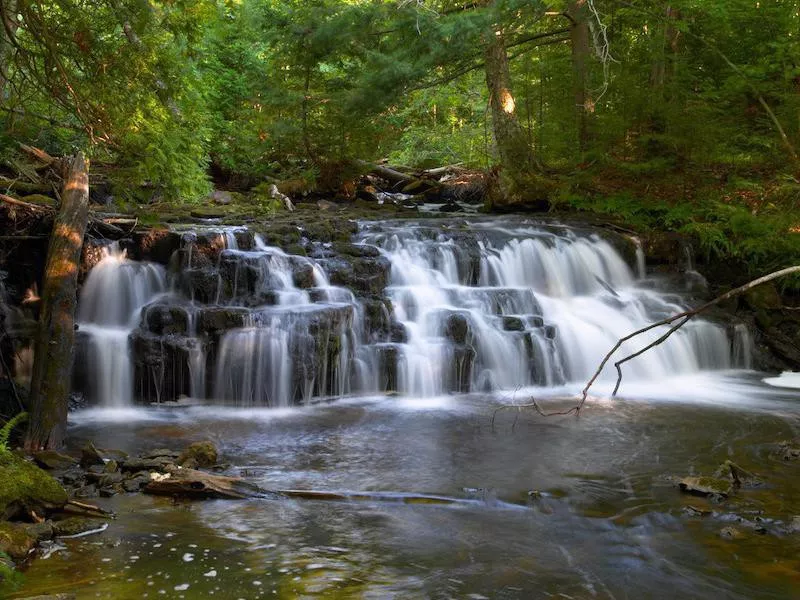
Getty
Length: 10.1 miles
Location: Shingleton
Duration: 4.35 hours
Difficulty: Moderate
Pictured Rocks National Lakeshore is a gorgeous setting of tree-covered cliffs along Lake Superior. This distance loop will take you to Mosquito Falls and Chapel Falls, but there are other trails in the area to enjoy as well.
Minnesota: Fifth Falls and Superior Hiking Trail Loop
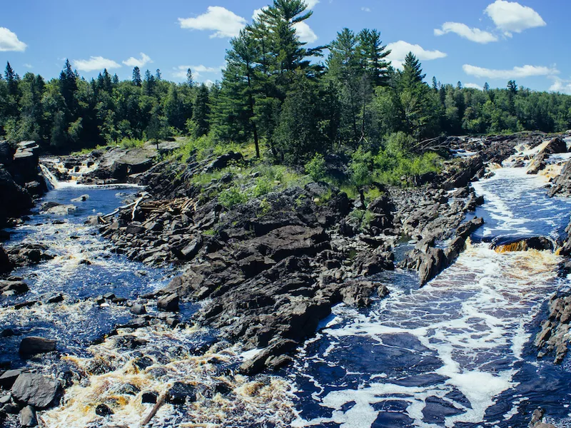
Length: 3.1 miles
Location: Two Harbors
Duration: 1.27 hours
Difficulty: Easy
You'll see more waterfalls on this loop, a shorter and easier trail in Gooseberry Falls State Park. The hike is pretty flat, with lots of other nearby trails around the rivers and lake if you're looking for more of a day hike.
Mississippi: Bear Creek Outcropping Trail
Length: 3.6 miles
Location: Dennis
Duration: 1.37 hours
Difficulty: Moderate
The waterfall theme continues with this trail in Tishomingo State Park. The trail has a short entry to reach the loop that features rock formations and a river.
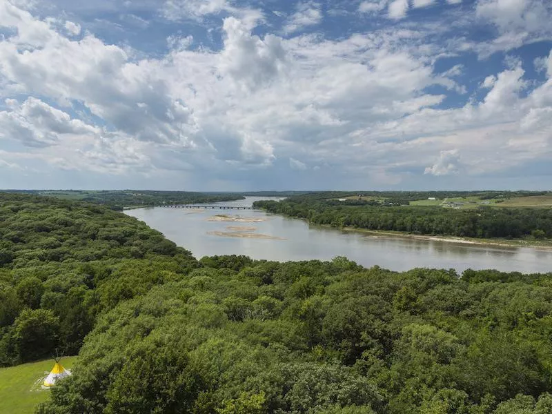
Missouri: Lewis and Clark Trail and Lewis Trail Loop
Length: 8.3 miles
Location: St. Charles
Duration: 3.55 hours
Difficulty: Moderate
Follow in the footsteps of Lewis and Clark with this loop trail in Weldon Spring Conservation Area, located outside of St. Louis. You'll spend a good portion of the trail walking beside the Missouri River.
Montana: Lava Lake (Cascade Creek) Trail
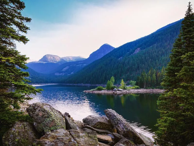
Getty
Length: 5.5 miles
Location: Gallatin Gateway
Duration: 3.19 hours
Difficulty: Moderate
Lave Lake, otherwise called Cascade Creek, has an out-and-back trail to enjoy a cool mountain lake, 1,620 feet above the sea. Located in Custer Gallatin National Forest, the trail also welcomes dogs and horses.
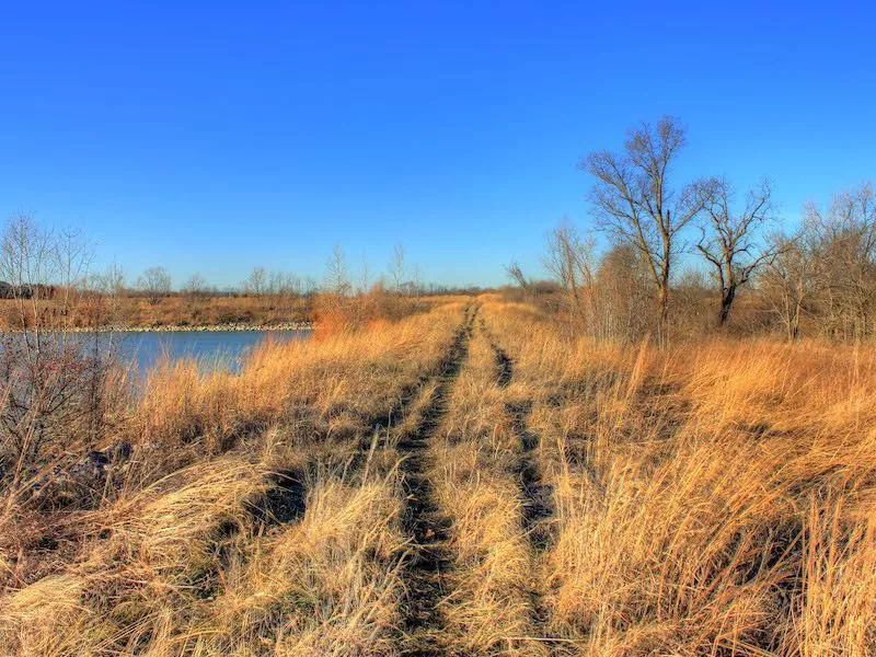
Nebraska: Platte River State Park Loop Trail
Getty
Length: 6.7 miles
Location: South Bend
Duration: 3.14 hours
Difficulty: Easy
Platte River State Park gives you a double loop trail along the river. The trail won't take you on any steep climbs for magnificent vistas, but you'll enjoy a lovely wooded walk.
Nevada: Calico Tanks Trail
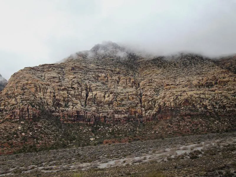
Getty
Length: 2.2 miles
Location: Las Vegas
Duration: 1.1 hours
Difficulty: Moderate
Leave the glitz and neon of Vegas behind for this trail through Red Rocks Canyon, just minutes outside the city. Go early, before the crowds and the heat, for this out-and-back trail.
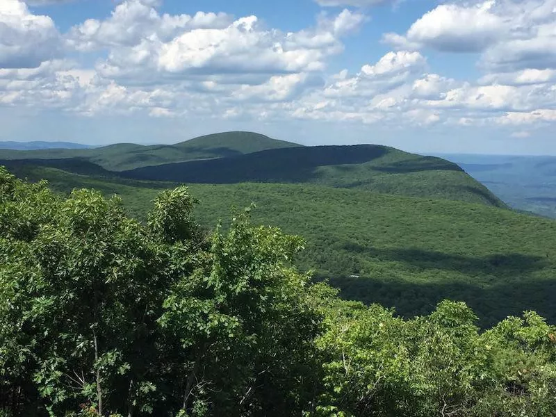
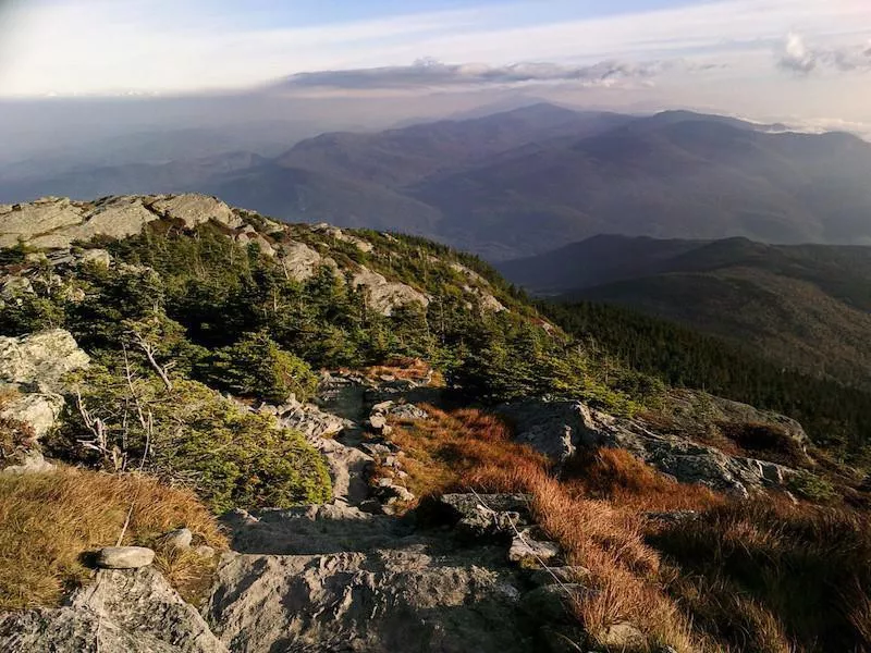
New Hampshire: Mount Lafayette and Franconia Ridge Trail Loop
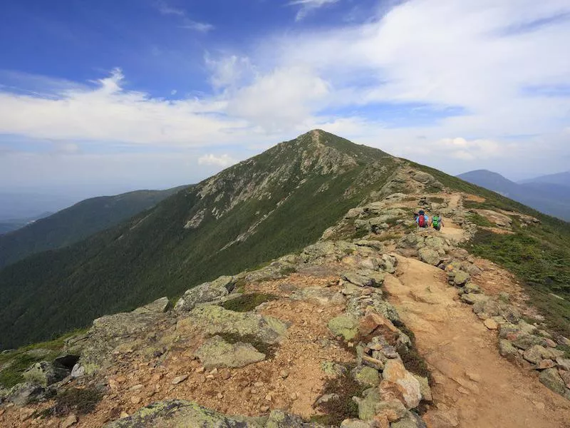
Getty
Length: 8.6 miles
Location: Lincoln
Duration: 6 hours
Difficulty: Hard
Deep within the White Mountains is one of the most popular trails in the entire state. The loop climbs Mount Lafayette and follows along Franconia Ridge in the Presidential Range, giving your presidential views from 3,822 feet. It also features a waterfall but is only recommended for experienced hikers.
New Jersey: Mount Tammany: Red Dot and Blue Dot Loop Trail
Getty
Length: 3.3 miles
Location: Knowlton
Duration: 2.8 hours
Difficulty: Moderate
Within the Worthington State Forest and the Delaware Water Gap, there are two trails that create a moderate hiking loop. You'll climb up 1,197 feet on the red dot loop trail, then enjoy a downward winding slope on the blue dot.
New Mexico: Wheeler Peak via Williams Lake Trail
Getty
Length: 8.2 miles
Location: Taos
Duration: 5.18 hours
Difficulty: Hard
In the winter, Taos is known for its ski trails. But when the weather warms, Carson National Forest's Wheeler Peak is a hotspot for duration hikes. This out-and-back trail will take you to elevations of 3,024 feet.
New York: Cascade Mountain and Porter Mountain
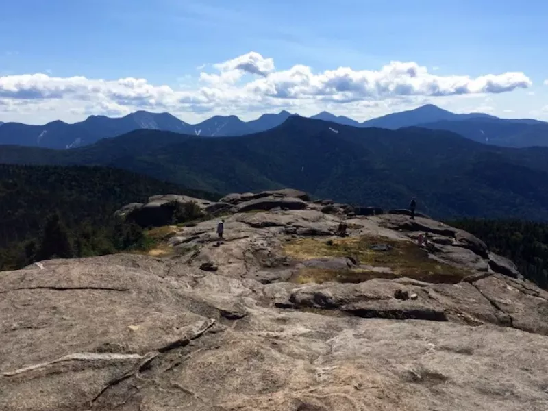
Length: 2.9 miles
Location: Lake Placid
Duration: 3.48 hours
Difficulty: Moderate
Follow the Cascade Mountain Trail within the High Peaks Wilderness to reach both Cascade and Porter Mountains. The out-and-back trail near Lake Placid reaches heights of 2,293 feet.
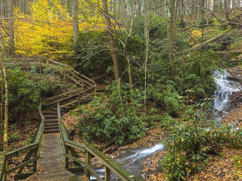
North Carolina: Looking Glass Rock Trail
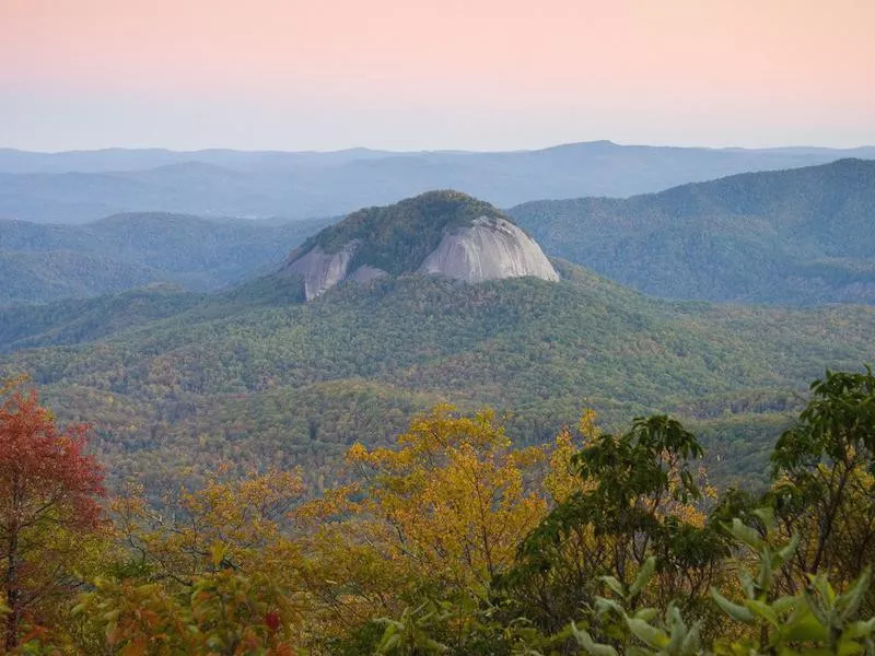
Getty
Length: 5.7 miles
Location: Brevard
Duration: 3.28 hours
Difficulty: Moderate
Prepare to climb steadily up 1,729 feet when following this trail through Pisgah National Forest. Along the way, check out a waterfall, and enjoy beauty of the Blue Ridge Mountains.
North Dakota: Caprock Coulee Loop
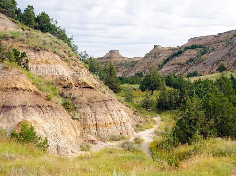
Getty
Length: 4.4 miles
Location: Watford City
Duration: 1.47 hours
Difficulty: Moderate
Where the Badlands meet the plains, Theodore Roosevelt National Park awaits. Find a moderate loop through the buttes, heavily marked and cared for by the park service.
Ohio: Ledges Trail
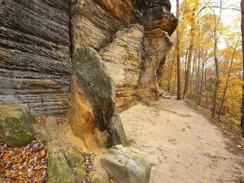
Getty
Length: 2.6 miles
Location: Hudson
Duration: 1.9 hours
Difficulty: Moderate
To reach the lodges of Cuyahoga Valley National Park, you'll loop most of the way except for an up-and-back trail that connects to the loop. There are a number of trails here, so make sure to take a trail map as you make your way back from the moderate loop as multiple trails converge, making it easy to get lost.
Oklahoma: Bison Trail
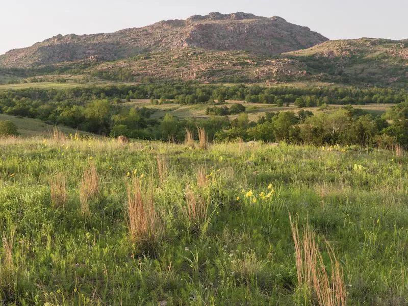
Getty
Length: 6.1 miles
Location: Indiahoma
Duration: 2.44 hours
Difficulty: Moderate
You may actually see some bison on this aptly named trail in the Wichita Mountains National Wildlife Refuge. The loop runs along rivers and lakes in a gorge, and you can bring your dog.
Oregon: Trail of Ten Falls
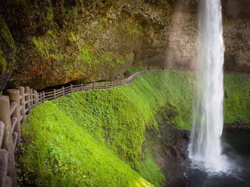
Getty
Length: 7.6 miles
Location: Silverton
Duration: 3.52 hours
Difficulty: Moderate
Follow the Trail of Ten Falls for exactly that: 10 waterfalls in the canyon of Silver Falls State Park. There are 9,400 acres in the park, and this trail is a moderate 1,194-foot loop. Don't forget your camera!
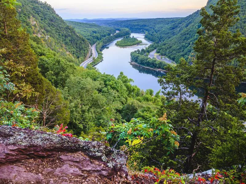
Pennsylvania: Mount Minsi
Getty
Length: 5.3 miles
Location: Delaware Water Gap
Duration: 2.53 hours
Difficulty: Moderate
Just as New Jersey's best trail can be found at the Delaware Water Gap, so, too, can Pennsylvania's, as the Delaware River carves between the two states. On this out-and-back trail, you'll climb 1,105 feet.
Rhode Island: Cliff Walk
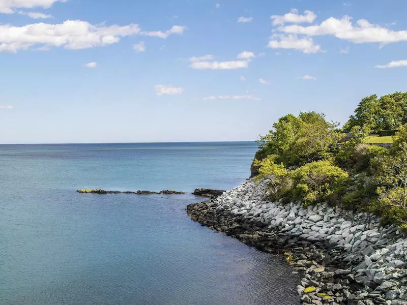
Getty
Length: 6.6 miles
Location: Newport
Duration: 2.52 hours
Difficulty: Moderate
Rather than a wooded hike, this really is a mild walk. But the feature of this walk along the water is that it passes the backyards of the famous Newport Mansions. Take in the views of the homes as you walk in one direction, and then enjoy the bay views as you make your way back.
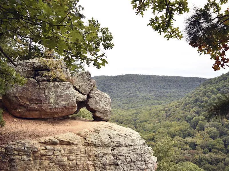
South Carolina: Table Rock Trail
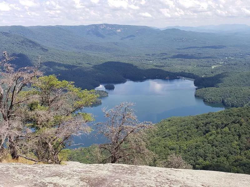
Length: 10.3 miles
Location: Pickens
Duration: 4.6 hours
Difficulty: Hard
Be prepared to climb — 2,240 feet — on this out-and-back trail. Your efforts will be rewarded with a waterfall as you make your way to the top of Table Rock.
South Dakota: Black Elk Peak South Dakota Highpoint Trail
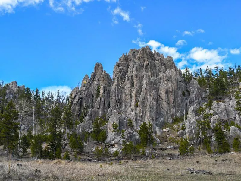
Getty
Length: 7.6 miles
Location: Custer
Duration: 4.6 hours
Difficulty: Moderate
Although you won't climb the 7,242-foot peak in the Black Hills National Forest, you will ascend 1,551 feet. Your hike will take you through the park's renowned rocky landscape.
Tennessee: Alum Cave Trail to Mount LeConte
Getty
Length: 10.5 miles
Location: Gatlinburg
Duration: 6.13 hours
Difficulty: Hard
Great Smoky Mountains National Park has seemingly endless miles of trails, but following the Alum Cave Trail to Mount LeConte will present unique rock formations and ample scenic views. The trail is popular, and there is a recreation center at the top of this out-and-back hike.
Texas: Guadalupe Peak Texas Highpoint Trail
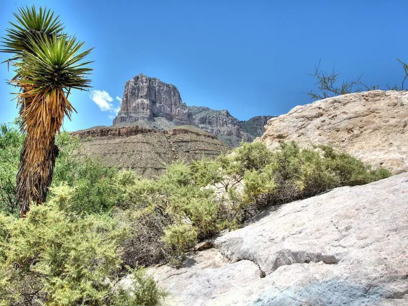
Getty
Length: 8.1 miles
Location: Salt Flat
Duration: 5.12 hours
Difficulty: Hard
Trek through Guadalupe Mountains National Park on this strenuous out-and-back trail. As you climb 2,867 feet, you'll get views from 8,749 feet — the highest "point" in Texas.
Utah: Lake Blanche Trail
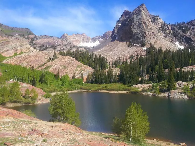
Getty
Length: 6.9 miles
Location: Sandy
Duration: 4.37 hours
Difficulty: Hard
Within Twin Peaks Wilderness, this difficult trail will have you scrambling up 2,706 feet. From the top, the reward is the view of the canyon at the lake and even Salt Lake City off in the distance.
Vermont: Camel's Hump Trail
Getty
Length: 6 miles
Location: Huntington
Duration: 4.1 hours
Difficulty: Hard
Camels Hump State Park, with its waterfall and mountain views worthy of a climb, offers its namesake trail. You'll ascend 2,578 feet and then loop at the top before descending back down on the same trail, although you could elect to follow other trails down.
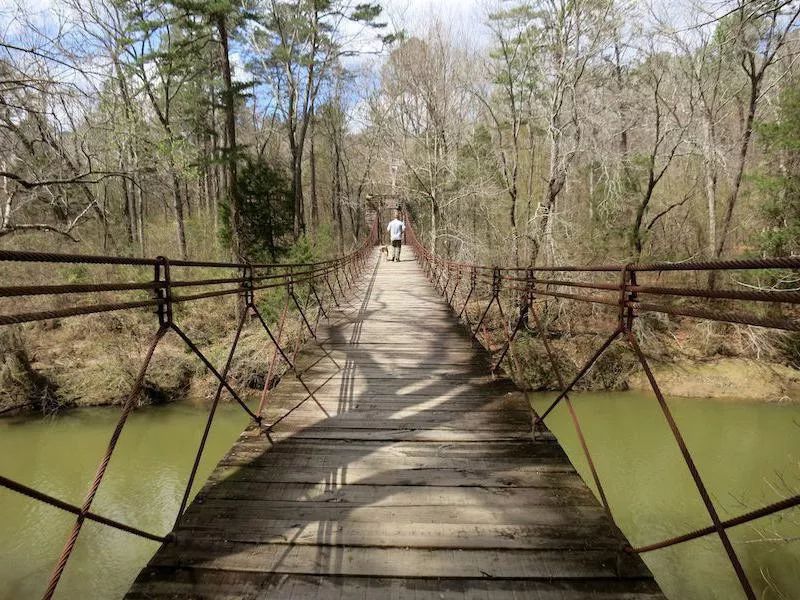
Virginia: Billy Goat and Chesapeake and Ohio Canal Trail Loop
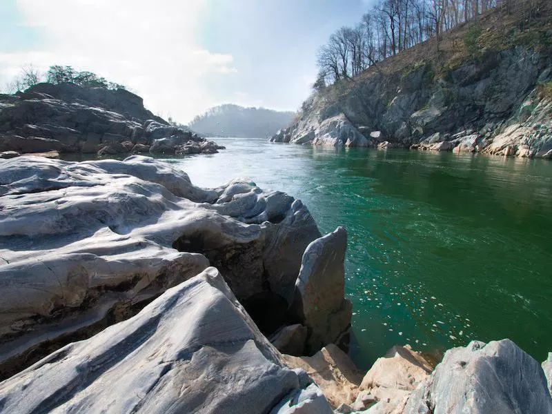
Getty
Length: 7.1 miles
Location: Great Falls
Duration: 3.3 hours
Difficulty: Moderate
Just outside of the Washington, D.C., Metro Area, this pretty hike takes you through Chesapeake and Ohio Canal National Historical Park on a double loop waterfall trail. It's a low-elevation trail made up of multiple smaller hikes for views from both sides of the canal and Potomac River.
Washington: Lake 22 Trail
Length: 7 miles
Location: Granite Falls
Duration: 3.49 hours
Difficulty: Moderate
This popular trail takes you on a 1,486-foot climb to Lake 22, where you'll get to loop around it before making your way back. Found in Mount Pilchuck State Park, it's best visited May through November.
West Virginia: Maryland Heights Loop
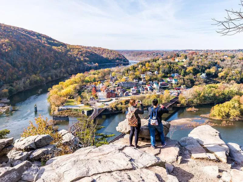
Getty
Length: 5 miles
Location: Harpers Ferry
Duration: 3.1 hours
Difficulty: Moderate
Where the Potomac River wraps around the borders of Maryland and West Virginia, you can visit Harpers Ferry National Historical Park and then make the climb to get a view of the charming historical town. The ascent is 1,473 on this looped hike.
Wisconsin: Devil's Lake via West Bluff Trail
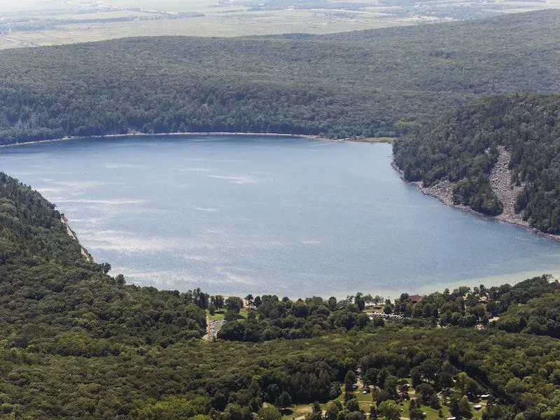
Getty
Length: 4.7 miles
Location: Baraboo
Duration: 2.34 hours
Difficulty: Moderate
Take a hike around this lake following the West Bluff Trail. Be forewarned that the trail may get crowded: Devil's Lake State Park gets mountain bikers, pets, runners and more.
Wyoming: Table Mountain Trail
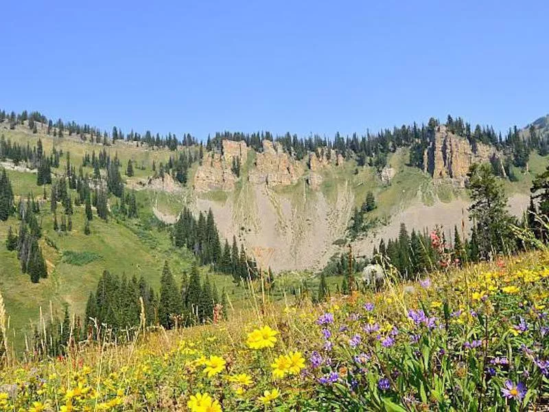
Length: 10.7 miles
Location: Alta
Duration: 7.7 hours
Difficulty: Hard
The Jedediah Smith Wilderness of Wyoming is home to Alta ski slope. But from March through September, grab your hiking poles and head up Table Mountain Trail, which features a climb before a loop around the mountaintop at an elevation of 4,146 feet.